TL;DR
- Rain turns to snow when temperatures are at or below freezing (32°F/0°C).
- The conversion ratio varies with temperature, typically starting at 10:1 and increasing as temperatures drop.
- Humidity, wind, and elevation can influence the snow-to-rain ratio.
- Understanding conversion helps with accurate weather forecasting and winter preparation.
- The process involves supercooling and ice crystal formation in clouds.
Understanding Rain to Snow Conversion
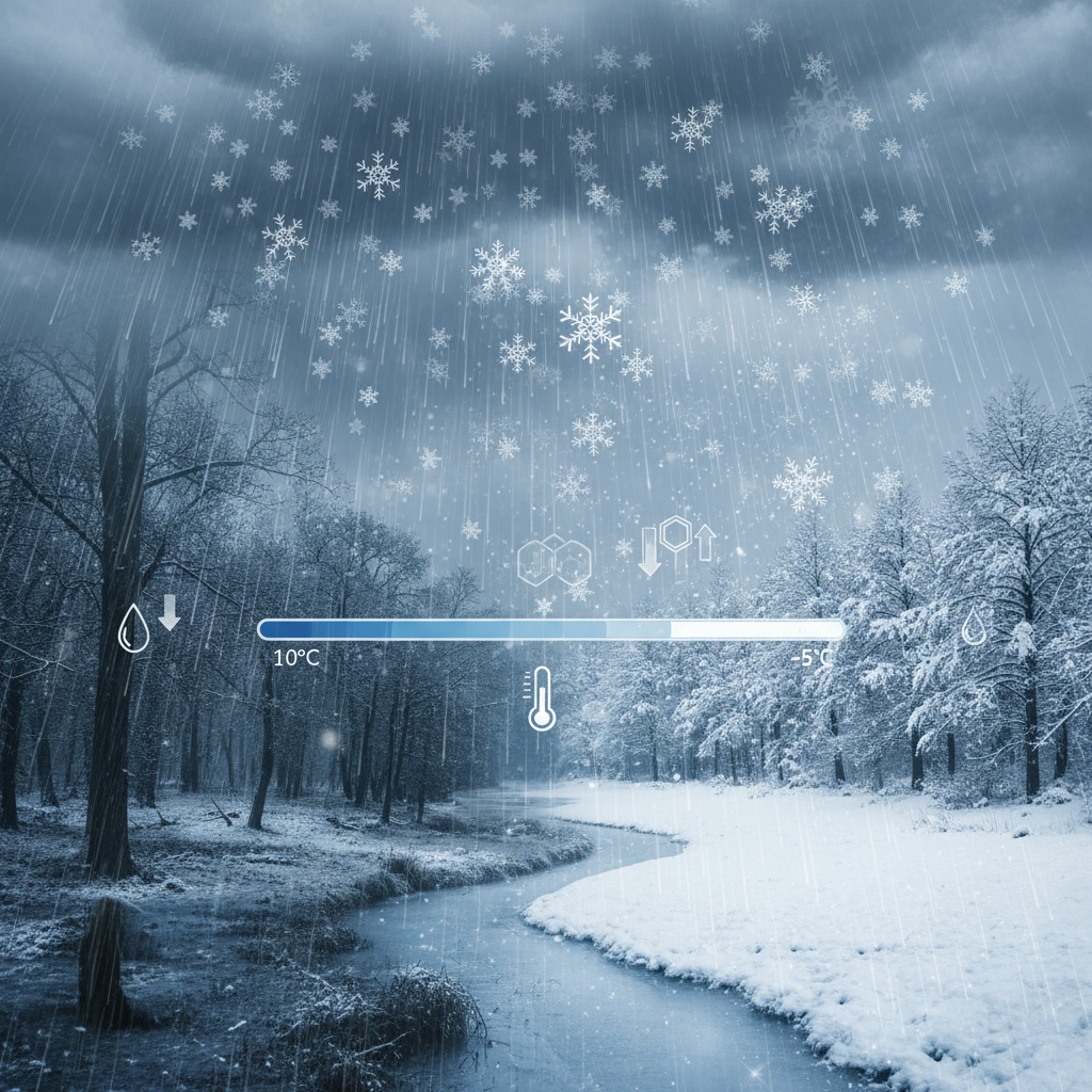
When winter weather forecasts predict precipitation, one of the most important questions is whether that precipitation will fall as rain or snow. The conversion from rain to snow depends on temperature, but it’s not as simple as “below freezing means snow.” Understanding the science behind rain-to-snow conversion can help you better prepare for winter weather and make sense of weather forecasts.
The Science of Precipitation Conversion
How Rain Turns to Snow
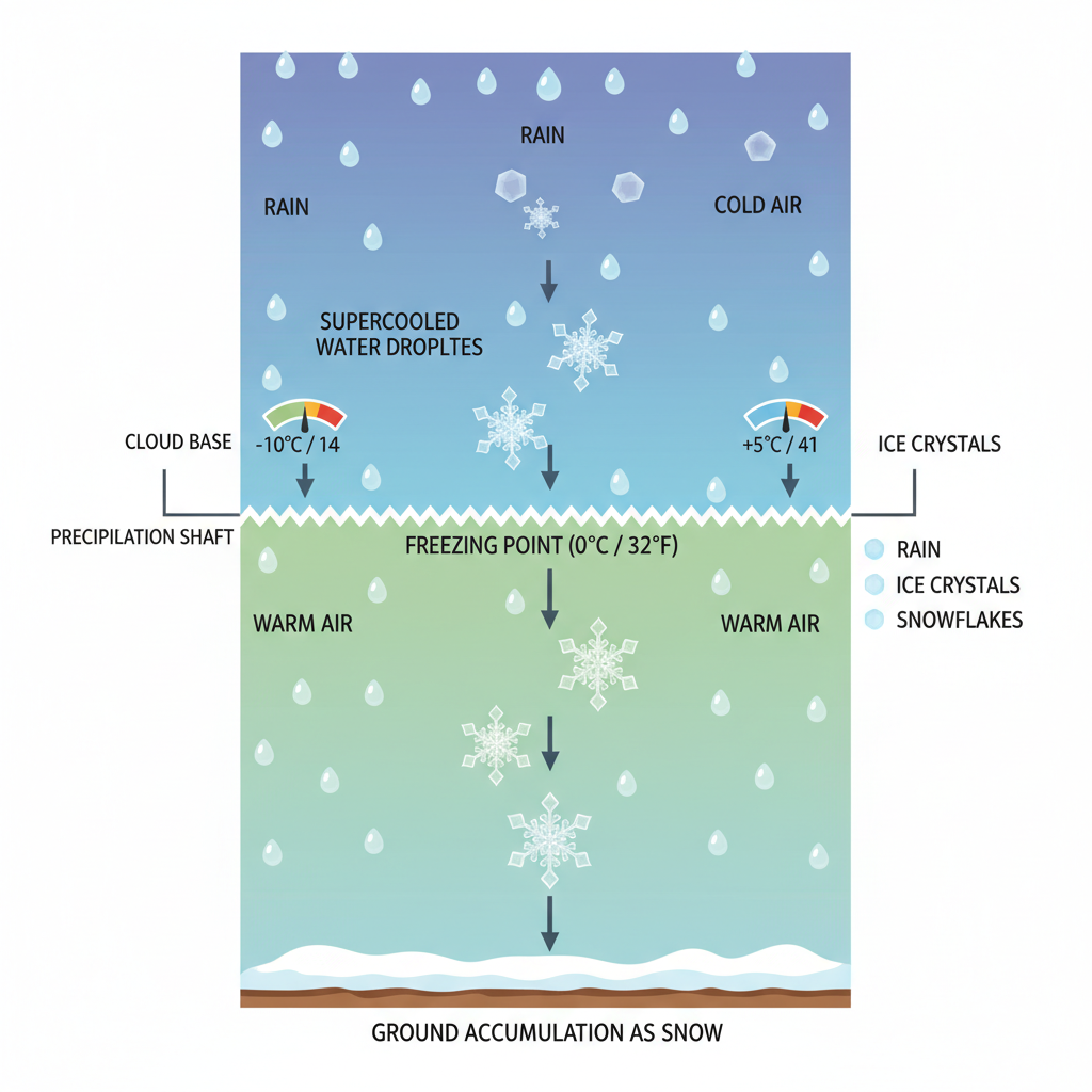
Precipitation begins as water vapor in the atmosphere. As warm air rises and cools, water vapor condenses into tiny water droplets or ice crystals, forming clouds. The type of precipitation that reaches the ground depends on the temperature at different levels of the atmosphere.
-
Rain: Forms when temperatures are above freezing throughout the cloud and down to the ground. Water droplets remain liquid.
-
Snow: Forms when temperatures are below freezing in the cloud, allowing ice crystals to form and grow. These crystals fall as snowflakes.
-
Mixed Precipitation: Occurs when temperatures are near freezing, creating sleet, freezing rain, or a mix of rain and snow.
The Freezing Point and Supercooling
Water can exist in liquid form below freezing through a process called supercooling. However, for snow to form, there must be ice nuclei - tiny particles around which ice crystals can form. In the absence of these nuclei, supercooled water droplets can remain liquid until they hit a surface or encounter an ice crystal.
Temperature-Based Conversion Ratios
The amount of snow produced from a given amount of rain depends on temperature. Warmer air can hold more moisture, and colder temperatures allow snowflakes to grow larger before falling.
Basic Conversion Formula
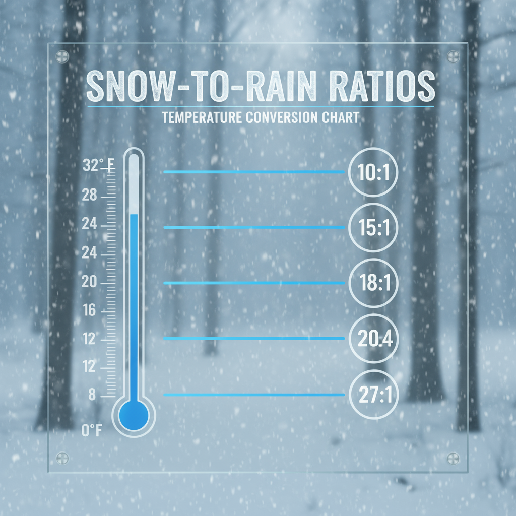
A common rule of thumb is the “10:1 rule”: 1 inch of rain produces 10 inches of snow at temperatures around 32°F (0°C). However, this ratio changes with temperature:
-
32°F (0°C): 10:1 ratio (1” rain = 10” snow)
-
20°F (-6°C): 15:1 ratio (1” rain = 15” snow)
-
10°F (-12°C): 20:1 ratio (1” rain = 20” snow)
-
0°F (-18°C): 30:1 ratio (1” rain = 30” snow)
Advanced Formula
A more precise formula accounts for temperature variations:
Snow Depth = Rainfall × (10 + (32 - Temperature°F) × 0.5)
This formula adjusts the ratio based on how far below freezing the temperature is.
Factors Affecting Rain-to-Snow Conversion
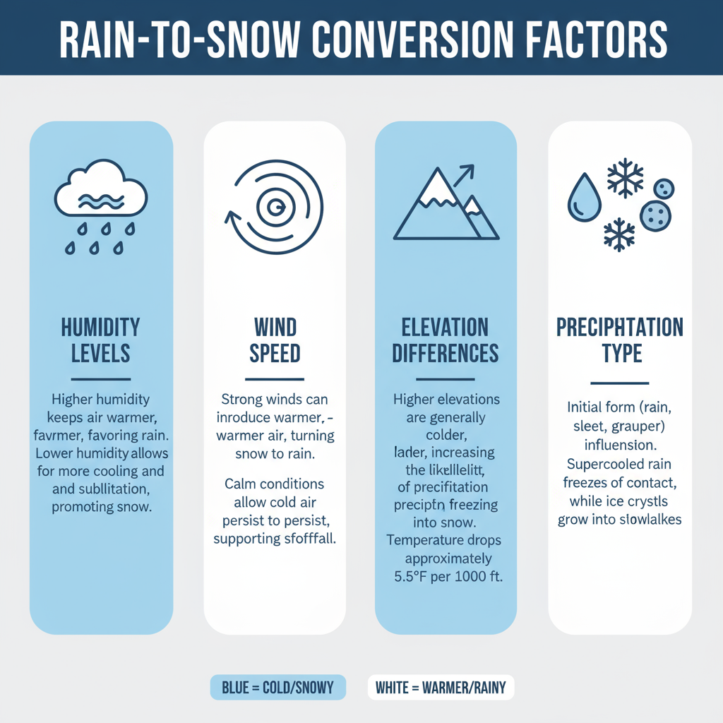
Humidity
Higher humidity allows snowflakes to grow larger and heavier, increasing the snow-to-rain ratio. Dry air produces lighter, fluffier snow.
Wind
Wind can affect how snow accumulates. Strong winds can blow snow around, creating drifts and uneven accumulation.
Elevation
Higher elevations typically have colder temperatures, leading to higher snow ratios. This is why mountain areas receive more snow from the same amount of precipitation.
Precipitation Type
The type of precipitation (frontal rain vs. convective showers) can affect the conversion process.
Practical Applications
Weather Forecasting
Understanding rain-to-snow conversion helps meteorologists provide more accurate snowfall predictions. Forecasters use models that account for temperature profiles throughout the atmosphere.
Winter Preparation

Knowing how much snow to expect from forecasted rain helps with:
-
Snow removal planning
-
Travel preparations
-
Business operations (especially for ski resorts, transportation companies, and outdoor event planners)
-
Emergency planning
Climate Change Implications
As global temperatures rise, the rain-to-snow conversion line is shifting northward. Areas that traditionally received snow may see more rain, affecting water resources, winter recreation, and ecosystems.
Common Misconceptions
-
“It has to be below freezing at the surface for snow”: Snow can fall through warmer air near the surface if the upper atmosphere is cold enough.
-
“The 10:1 rule is always accurate”: The ratio varies significantly with temperature and other factors.
-
“Snow is just frozen rain”: Snow forms through a complex process of ice crystal growth, not simply freezing raindrops.
Conclusion
Rain-to-snow conversion is a fascinating interplay of temperature, humidity, and atmospheric dynamics. While the basic principles are straightforward, the actual conversion process can be complex and variable. By understanding these factors, you can better interpret weather forecasts and prepare for winter precipitation, whether it’s rain or snow.